Shoreline restoration, Buckhorn and Chemong Lakes

Shoreline restoration on Buckhorn and Chemong lakes, from Buckhorn to Bridgenorth

We re-slope and armour eroded banks on Buckhorn, Chemong and Lower Buckhorn, and we prepare the Otonabee Conservation and Parks Canada permits. Send the form and an owner calls you back today.

  • ✓Same-day callback from an owner
  • ✓Conservation authority and Parks Canada permits filed for you
  • ✓River rock, native planting and stone steps, one crew
Get your free shoreline consult
A few quick questions. An owner calls you back today.
Prefer to talk? Call (705) 208-7121
32 reviews, most of them for yards and stone work
Owners on site
One or both owners on site every day of the build
Our own machines
Excavators and skid steers we own, so the base and the stone are one crew's work
Locates before every dig
Ontario Dig Authority locate filed before the machine arrives

Shoreline restoration on Buckhorn and Chemong Lakes

We do shoreline restoration on Buckhorn and Chemong lakes for cottage and year-round owners from Buckhorn village and Ennismore to Bridgenorth, Deer Bay and Lower Buckhorn. Chemong, Buckhorn and Pigeon share one water level, set at the Buckhorn dam, but the permits here run differently than on the lakes upstream: Otonabee Conservation regulates all of Chemong and the south shores of Buckhorn. We re-slope eroded banks, take out failed walls, armour the slope with river rock and replant it.

Shoreline restoration

Bank washing into the lake, an old wall leaning out, ice shoving the stone around every spring? You get a shoreline rebuilt to hold, in the form the permit offices approve.

  • ✓Eroded banks re-sloped and armoured with river rock on a 3:1 slope
  • ✓Failed timber, concrete and stone walls taken out
  • ✓Native planting and a no-mow buffer that roots the bank
  • ✓Armour stone steps and seating walls up the bank to the water
  • ✓Machine and stone access planned, the site restored when we leave

The permits, handled

On the Kawartha lakes most shoreline jobs need two approvals, and the calendar matters as much as the paperwork. You sign; we prepare and file.

  • ✓Your survey checked for a City shoreline road allowance
  • ✓Pre-consultation and permit with Kawartha Conservation or Otonabee Conservation
  • ✓Parks Canada in-water and shoreline works application on Trent-Severn lakes
  • ✓The build timed to the fish-spawning window
  • ✓Every approval in hand before a machine touches the bank

We run our own excavators and skid steers, so the grading, the stone and the planting are one crew's work, with an owner on site every day.

We design to what the conservation authority and Parks Canada approve. If what you picture is a vertical armour stone wall at the waterline, you hear at the first visit what gets permitted instead, before you spend a dollar on drawings.

Shorelines on Buckhorn and Chemong Lakes: what the permits allow

Who signs off

Otonabee Conservation regulates the entire Chemong shoreline and the south shores of Upper and Lower Buckhorn, Deer Bay included, under O. Reg. 41/24, in force since April 1, 2024. It aims to deem an application complete within 21 days and decide a minor permit 21 days later, or 28 for a major one. Otonabee only considers work above the Upper Controlled Navigation Limit; below it, Parks Canada issues the permit. On the Trent Lakes north shores, owners in the former Harvey township are sent to Kawartha Conservation. Selwyn sells shoreline road allowances from $2,500 once Council deems them surplus; Trent Lakes charges $7.50 per m².

What gets approved

Buckhorn and Chemong share one level with Pigeon Lake, set by the Trent-Severn dam at Buckhorn, where the full navigation level is about 246 m; the level is lowered over winter ahead of spring runoff. Below Lock 31 and its average 3.5 m lift, the regulatory flood elevation drops from 247.12 m to 244.31 m on Lower Buckhorn and Deer Bay. Otonabee's watershed turns to the rocky, forested Canadian Shield at its northern edge, with granite visible in the north. Parks Canada warns paddlers of strong head and cross winds on Upper Buckhorn Lake and of powerboat wake.

The calendar

Curve Lake First Nation's territory is a mainland peninsula and Fox Island on Buckhorn and Chemong lakes. Its Consultation and Accommodation Standard, adopted in 2013, lists the issuing of permits and any activity that may affect wild rice beds, fish or archaeological sites among the triggers for notice and consultation. Trent Lakes lists the standard among the agencies to check before a project, and Selwyn Township posts it. On these two lakes it belongs in the permit file from the first day.

Communities we cover from here

BuckhornBridgenorthEnnismoreCurve LakeBuckhorn Lake EstatesGannon's NarrowsDeer BayLower Buckhorn LakeSelwyn Beach Conservation Area

How shoreline restoration on Buckhorn and Chemong Lakes works, in four steps

1
Tell us about your waterfront
Send the form or call. An owner calls you back the same business day.
2
An owner walks the shoreline
We measure the frontage, photograph the bank, check your survey for a shoreline road allowance, and work out how machines and stone get in.
3
We file the permits
Pre-consultation with the conservation authority, then the applications to it and to Parks Canada with the site plan and photos they ask for.
4
Build in the open window
Stone, grading and planting when the fish window allows, then a walk-through and your written warranty.

Stone work we have built

Armour stone wall and steps built by Thor Construction
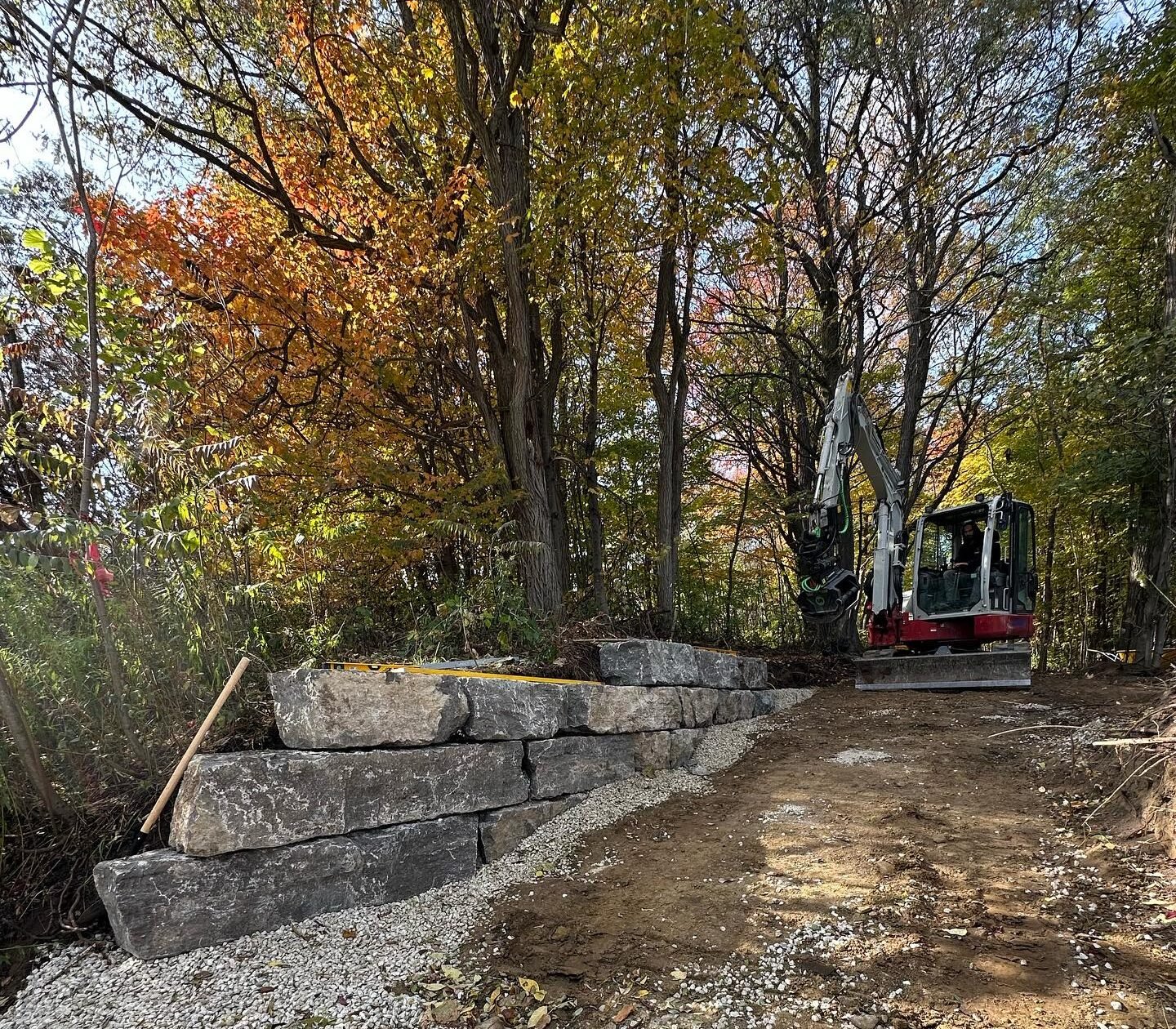
Armour stone going in on a Thor Construction job
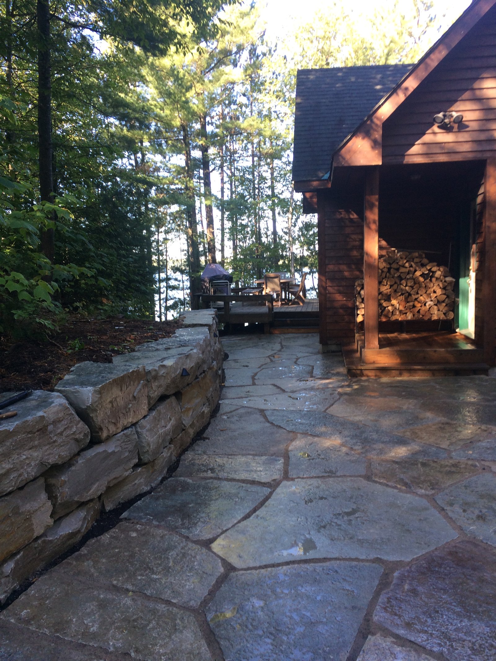
Flagstone path and armour stone by Thor Construction

What our customers say

★★★★★

“Thor Construction company did some hardscaping for us in our backyard around the pool. Right from the start they were responsive, they worked with us on a design that was functional for the space and stayed within the agreed budget. Their work was fabulous!”

D 1072
Pool surround, hardscaping · Google review
★★★★★

“Thor construction company did a great job on my landscaping for my new home, great design idea for my garden and driveway and walkway plus patio thanks for the great job, we highly recommend them”

Jeremy Thorsen
New home, full landscaping · Google review
★★★★★

“Can't say enough about Thor Construction Company. They transformed my backyard space into a perfect little getaway; can't wait to host this summer! They were professional, hardworking bunch and I would recommend you chose this company for your backyard or landscaping needs...big or small!”

Matthew Tynkaluk
Backyard rebuild · Google review

Shoreline restoration on Buckhorn and Chemong Lakes: your questions answered

Who issues the shoreline permit on Chemong Lake?

Two offices. Otonabee Conservation regulates the whole Chemong shoreline but only considers work above the Upper Controlled Navigation Limit. Below that line, Parks Canada issues the in-water and shoreline works permit for the Trent-Severn Waterway. We prepare and file both applications.

Does Otonabee Conservation cover the north shore of Buckhorn Lake?

No. Otonabee's floodplain mapping lists the south shores of Upper and Lower Buckhorn, Deer Bay included, as inside its jurisdiction, and it mapped the north shores on behalf of Trent Lakes. Trent Lakes points owners in the former Harvey township to Kawartha Conservation. We confirm the authority for your lot first.

How long does a shoreline permit take on Buckhorn or Chemong?

Otonabee aims to review an application for completeness within 21 days, then decide a minor permit within 21 days or a major one within 28. Parks Canada asks for applications several months before the start, and a 2022 Chemong wall replacement went out for a month of public comment on the federal registry. We file early.

Do I need a permit to fix my shoreline?

On the Kawartha lakes, almost always two. Parks Canada permits all work on the bed and waters of the Trent-Severn lakes, including shoreline stabilization, and the conservation authority permits work in its regulated area along the shore. We prepare and file both.

Can I put an armour stone wall at the water's edge?

Kawartha Conservation's published guidance steers away from hardened shorelines, meaning retaining walls, sheet piles and armour stone at the water's edge. What it recommends is river rock in mixed sizes on a 3:1 slope along the natural contour, native plants and a no-mow buffer. We design to that, and put armour stone where it earns its place: steps, seating walls and terraces up the bank.

When can the work happen?

On lakes that hold walleye and bass, which is most of the Kawarthas, Fisheries and Oceans Canada's timing window keeps in-water work off-limits from March 15 to July 15 while fish spawn. Parks Canada permits are valid for one year, so we file in fall or winter and schedule the build for the open window.

How long do the permits take?

Kawartha Conservation publishes its timelines: a streamlined permit is checked for completeness in 10 days and issued within 14 more, a standard minor permit in 14 plus 21 days. Parks Canada asks for applications several months before the start date. That is why fall is the time to start.

Can you take out an old wall?

Yes. Removing a failed timber, concrete or stone wall is shoreline work too, so it goes through the same permits, and the bank is re-sloped and planted where the wall stood.

How is a shoreline priced?

By the length of frontage, the slope, how machines and stone get to the water, and what the permits require. You get a written price after the site visit, with the permit work priced in the same quote.

Other areas and services

Every page has the local permit office, the ground and the rules for that area.

Ready to get your shoreline permitted, Buckhorn and Chemong Lakes?

Send the form and an owner calls you back today. Or call now and talk to the person who will dig the job.

Get your free shoreline consult
A few quick questions. An owner calls you back today.
Prefer to talk? Call (705) 208-7121
Thor Construction Company
Bobcaygeon, Ontario · Serving Central Ontario, north of the GTA
Call Now